• Skip to primary navigation
  • Skip to main content
  • Skip to primary sidebar
  • Skip to footer
  • Board Meetings
  • Public Notices
  • Financial
  • Land Use Applications
  • OPRA
  • Keegan Landfill Info & Updates

New Jersey Sports and Exposition Authority

  • Home
  • About
    • Executive Leadership & Board of Commissioners
    • Who We Are
    • Directions
    • The Meadowlands District
    • By-Laws
    • Job Opportunities
    • Contacts
  • Land Use Management
    • Application Process and Forms
    • Regulations
    • Zoning Map
    • Redevelopment Plans
    • Master Plan
    • Transportation
    • Floodplain Management
    • Affordable Housing
    • Zoning Officer of the Day
  • Parks & Programs
    • NJSEA Park Information
    • Upcoming Events and Walks
    • Parks and Trails
    • NJSEA Drone Policy
    • Meadowlands Tours
    • Marinas and Boat Launches
    • William D. McDowell Observatory
    • Wedding Policy
  • Resources
    • Municipal Equipment Pool
    • Geographic Information Systems
    • Interactive Municipal Maps
    • Emergency Response Information
  • Research & Education
    • MRRI
    • Library
    • Meadowlands Environment Center
    • School Programs
    • Scout Programs
    • Development for Educators

Interactive Municipal Maps

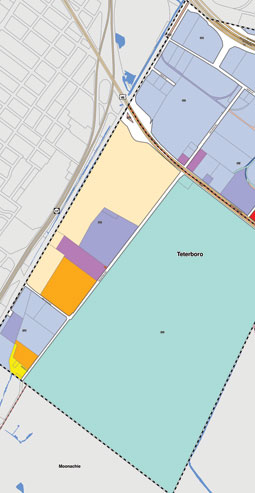
The Geographic Information Systems (GIS) group uses state-of-the-art technology to create, maintain and update comprehensive, web-based digital maps and mapping tools for every property in each Meadowlands District municipalhe Geographic Information Systems (GIS) group uses state-of-the-art technology to create, maintain and update comprehensive, web-based digital maps and mapping tools for every property in each Meadowlands District municipality.  

The maps are also a useful, time-saving tool for municipal officials who use property data to manage municipal assets and plan for infrastructure and other improvements. Data stored on each facility or residential property includes owner, block and lot, easements, address, zoning and land use, acreage, and building footprint. Building code and tax officials can produce property boundaries utilizing a buffer tool, which can save time in notifying residents of variance requests or other proposed changes to surrounding properties.

Primary Sidebar

About the NJSEA

Land Use Regulations

Resources

Parks & Nature Programs

Renewable Energy & Energy Efficiency

Research & Education

NEW JERSEY SPORTS & EXPOSITION AUTHORITY

CONTACT INFORMATION

Administration Offices: 201.460.1700
Email: info@njsea.com

MAP

QUICK LINKS

  • Land Use Applications
  • Directions
  • Nature Blog
  • Meadowlands Tours

Footer

QUICK CONTACT

One DeKorte Park Plaza
P.O. Box 640
Lyndhurst, NJ 07071
Admin Offices: 201.460.1700
Contact List
Notice of Claim Form

© 2023 New Jersey Sports and Exposition Authority

RELATED SITES

  • Meadowlands Liberty Convention & Visitors Bureau
  • Meadowlands Chamber
  • Meadowlands Conservation Trust
  • State of New Jersey
  • NJDCA
  • OPRA

RESOURCES

  • Monthly Meetings
  • Public Bids and Notices
  • Financial Information
  • Land Use Applications

Web Developers Studio